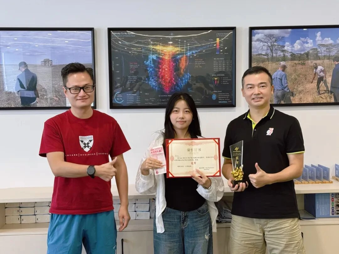
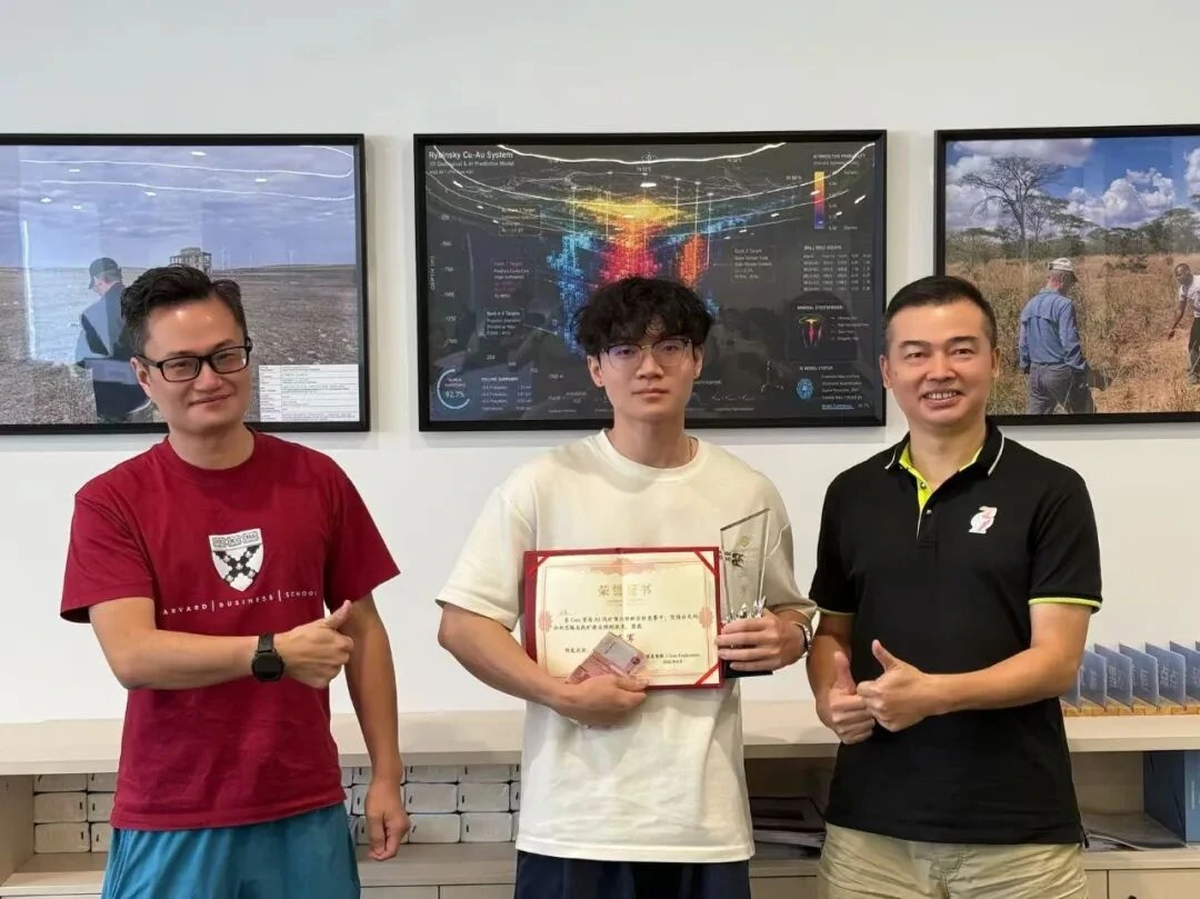
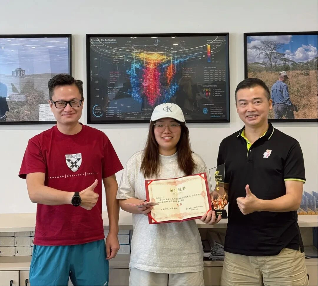
GAIA Exploration recently held an internal Mineral Prospectivity Analysis and Prediction Competition. The winner, Li Diandian, had not received systematic training in geology and was not an AI algorithm engineer whose main work involved model training and parameter tuning. Yet by directing multiple large language models (LLMs), she completed an end-to-end analytical process—from information retrieval and evidence organization to target judgment and report delivery—and produced predictions that closely matched the actual situation. The result prompted the team to discuss how exploration work is changing.
What deserves attention in this competition is how AI participated in a complex exploration task. Mineral exploration is never a one-question, one-answer exercise, and it does not end when a model produces a probability. The real challenge is how to organize geology, remote sensing, geochemistry, spatial information and historical records into an evidence chain that is explainable, reviewable and verifiable when the data are incomplete, several interpretations remain possible and false positives are common.
From this perspective, the internal competition was also a stress test for a new way of working in exploration. When AI takes on information retrieval, extraction from unstructured materials, spatial-data organization and comparison of competing hypotheses, can people devote more attention to problem definition, evidence review, risk boundaries and the next validation step? For mining business owners, this affects whether early-stage projects can narrow the search space more quickly. For geological engineers, it concerns how AI enters professional workflows. For people working across AI and mining, it points to a shift in the core barriers of a vertical industry.
01Build an explainable geological reasoning process
For a gold project in Indonesia, Li Diandian used ChatGPT, Google Earth, Python and public geoscience databases to divide the task into a sequence of inspectable steps: observation, hypothesis, quantification, integration, falsification, delineation and review. Every step needed an explicit basis and had to withstand examination, so the AI analysis could be traced and audited.
One of the key judgments was knowing when not to model. The source materials show that, without original remote-sensing rasters and reliable mineralization labels, she did not force methods such as PCA or Isolation Forest to generate a seemingly precise “mineralization probability.” In the Tanzania project, because the sample was small and the sampling design was not systematically random, she set the machine-learning weight directly to 0%. Whether a model should be used, and how much weight its output should carry, must depend on data quality and geological constraints.
This restraint is especially important in early exploration. Exploration data are often sparse, heterogeneous in origin and inconsistent in scale, and a high model score does not necessarily indicate a high-value target. GAIA therefore pays closer attention to explainable AI and evidence-driven exploration: every judgment should state its basis, possible alternative explanations and the method for the next validation step.
02An anomaly is not an orebody: use competing hypotheses to avoid false calls
After an explainable process has been established, the next task is to test what an anomaly actually means. Changes in remote-sensing tone and high geochemical values may relate to mineralization, but they can also come from bare ground, tropical weathering, modern engineering disturbance, sampling effects or instruments. A reliable AI workflow therefore seeks supporting evidence while actively checking evidence that could overturn the conclusion, instead of treating “anomaly” as equivalent to “mineralization.”
When the project presented remote-sensing anomalies, the team used AI to help check for modern anthropogenic disturbance. Historical Google Earth imagery from around 2012 was reviewed to see whether obvious engineering activity already existed in the core of the highest-priority target, T01. The original report showed that the area was then dominated by natural vegetation, reducing the credibility of the explanation that the anomaly was caused entirely by modern activity. Non-mineral explanations such as intense tropical weathering, laterite and bare ground were nevertheless retained for further testing.
This demonstrates the value of competitive hypotheses: place several possible explanations in the same evidence framework, then compare how much support each receives and what questions remain. For mining companies, this helps expose risk. Target ranking must consider not only evidence that supports mineralization but also factors that may invalidate the target.
A high pXRF value is not a gold anomaly
Before testing an interpretation, the reliability of the data itself must be checked. In the Tanzania project, AI helped the team review the credibility of field portable XRF (pXRF) data. The source material noted that its Au readings were susceptible to spectral interference from elements including As, Zn and W, so a single high Au value was not accepted directly as evidence of gold mineralization.
The analysis instead focused on more stable multielement responses such as Cu–Ag–Pb–As and treated the “placer-gold transport effect” as an important non-mineral competing explanation. In other words, before data enter a model, they need data-quality control and a geological plausibility check; their weight can then be assigned accordingly.
This step is especially important for field operations. AI can process large amounts of data quickly, but if instrument error, sampling bias and spatial transport effects go unrecognized, faster calculation may simply amplify mistakes faster. A system that truly supports exploration decisions must therefore incorporate data reliability into its reasoning.
04AI processes information; people retain decision authority
Whether comparing hypotheses or reviewing data, the division of work between AI and people must be explicit. In the competition, the large language models mainly supported information retrieval, extraction from unstructured material, spatial-data organization, analysis of evidence relationships, comparison of competing hypotheses and report preparation. The final exploration judgment still had to be reviewed by people.
For example, when dealing with specialist settings such as Indonesia’s Miocene Dolokapa volcano-sedimentary sequence and Tanzania’s NW–SE brittle to brittle-ductile deformation zone, Li first decomposed the problem and then directed AI to retrieve authoritative geoscience sources. The regional mineralization facts extracted from those sources were cross-checked against remote sensing, structure and spatial target information. In the original materials, existing studies classified the relevant mineralization as a low-sulfidation epithermal system; that understanding was then used to constrain the interpretation of core targets including T01.
This is consistent with GAIA’s continuing emphasis on AI + HI—the collaboration of artificial intelligence and human intelligence. AI expands information-processing capacity, while geologists and project teams retain professional review and final decision authority. For corporate clients, the value of this collaboration is that experts can concentrate their time on higher-value judgment, validation and engineering deployment.
The new professional barrier: orchestrating the workflow
For this division of work to deliver real value, different tools and tasks must be connected effectively. As general-purpose models become easier to obtain, simply “knowing how to use ChatGPT” is unlikely to create a lasting advantage. The scarcer capability is workflow orchestration: knowing when to ask an LLM to understand documents, when to use Python for spatial calculation, when to return to Google Earth to inspect historical imagery, when expert review is required, and when model inference should stop because the data are insufficient.
This capability has four layers. Problem definition turns a vague question such as “where is the ore?” into testable questions. Multisource geoscience-data integration brings remote sensing, geology, geochemistry, geophysics and historical materials into the same evidence framework. Uncertainty management separates dependable conclusions from hypotheses that still need testing. Human-in-the-loop validation keeps model output under expert review and correction by field data. Together, the four determine whether an analysis can move from information processing to reliable judgment.
Professional barriers are therefore moving in the AI era. The threshold for retrieving knowledge has fallen, but the demands placed on geological mechanisms, evidence quality, task orchestration and engineering validation have risen. For geological engineers, AI can amplify professional capability. For mining companies, the value of a system must ultimately appear in clearer target priorities and validation paths.
06A closer look at the geoscience agent platform
The competition showed one way in which AI and people can collaborate on geological analysis: AI assists with processing materials, organizing evidence and executing tasks, while professionals remain responsible for review and judgment. GAIA Exploration’s next stage will focus on expanding the Gaia Geoscience Agent Platform so geologists and mining clients can understand this way of working and apply it to real projects.
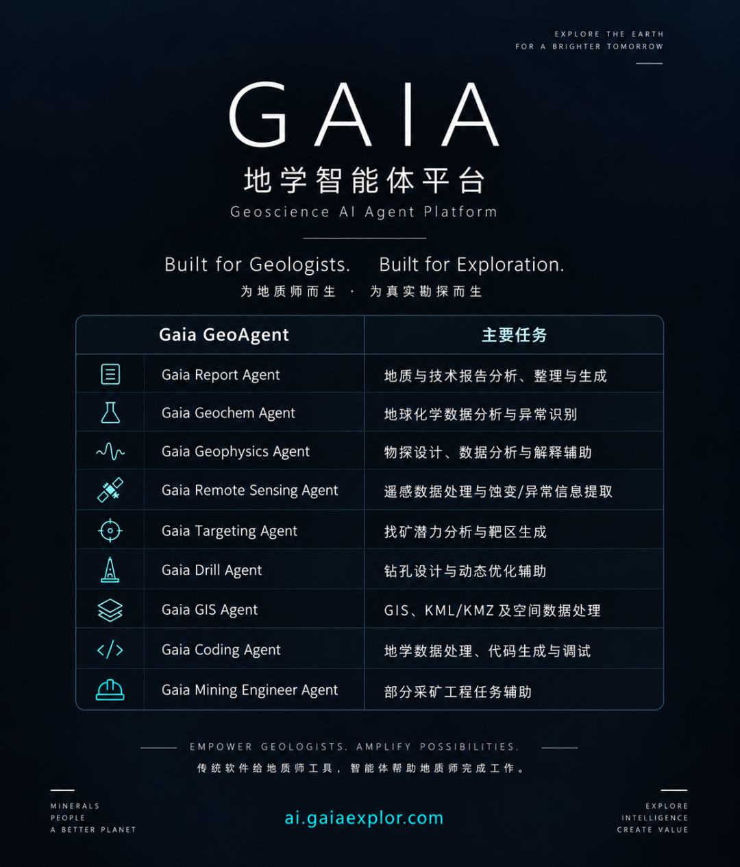
The platform configures specialist agents for report analysis, geochemistry, geophysics, remote sensing, targeting, drilling and GIS. Geologists define the problem and its boundaries; agents help call data, models and tools, produce analytical results, maps and reports, and then return the work to professionals for review. By linking these steps in one project environment, the platform aims to reduce repeated document organization, tool switching and restatement of project context, allowing professional judgment to remain the focus.
For mining companies, mineral-rights holders and investment institutions, the platform can help organize evidence, compare targets, identify data gaps and risk, and provide a basis for subsequent investment and validation. Teams with related needs are welcome to explore the Gaia Geoscience Agent Platform and assess its value against their tasks. Target judgments still require validation through reconnaissance, sampling, geophysics and drilling, completing a loop of data, judgment, validation and feedback.

Lower the entry barrier, raise the standard of judgment
Looking back at Li Diandian’s winning process, what matters is how she used AI: she did not worship the model, avoid disconfirming evidence, package a small sample as a probability, or write an anomaly directly into the report as an orebody. AI helped her cross the barriers of knowledge retrieval and information processing, but scientific method, rigorous reasoning and an awareness of validation determined whether the information could become a reliable judgment.
In the future, human–machine collaboration in mining will increasingly take the form of reorganized workflows. Machines will handle larger-scale information processing and evidence connection; people will remain responsible for problem definition, professional review, risk acceptance and engineering decisions.
For GAIA Exploration, the goal of AI mineral exploration is to make every target judgment better grounded, more traceable and more verifiable—and ultimately to serve real resource discovery and mining decisions.