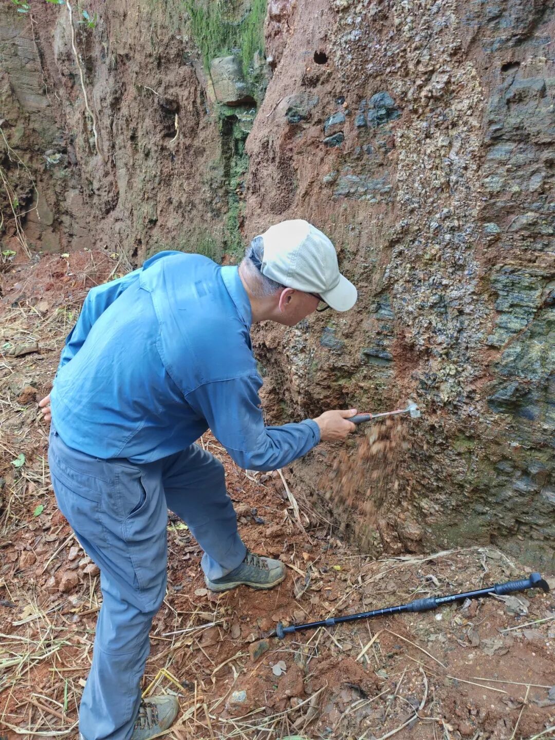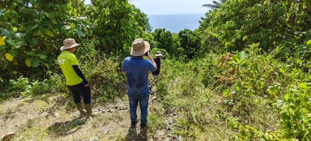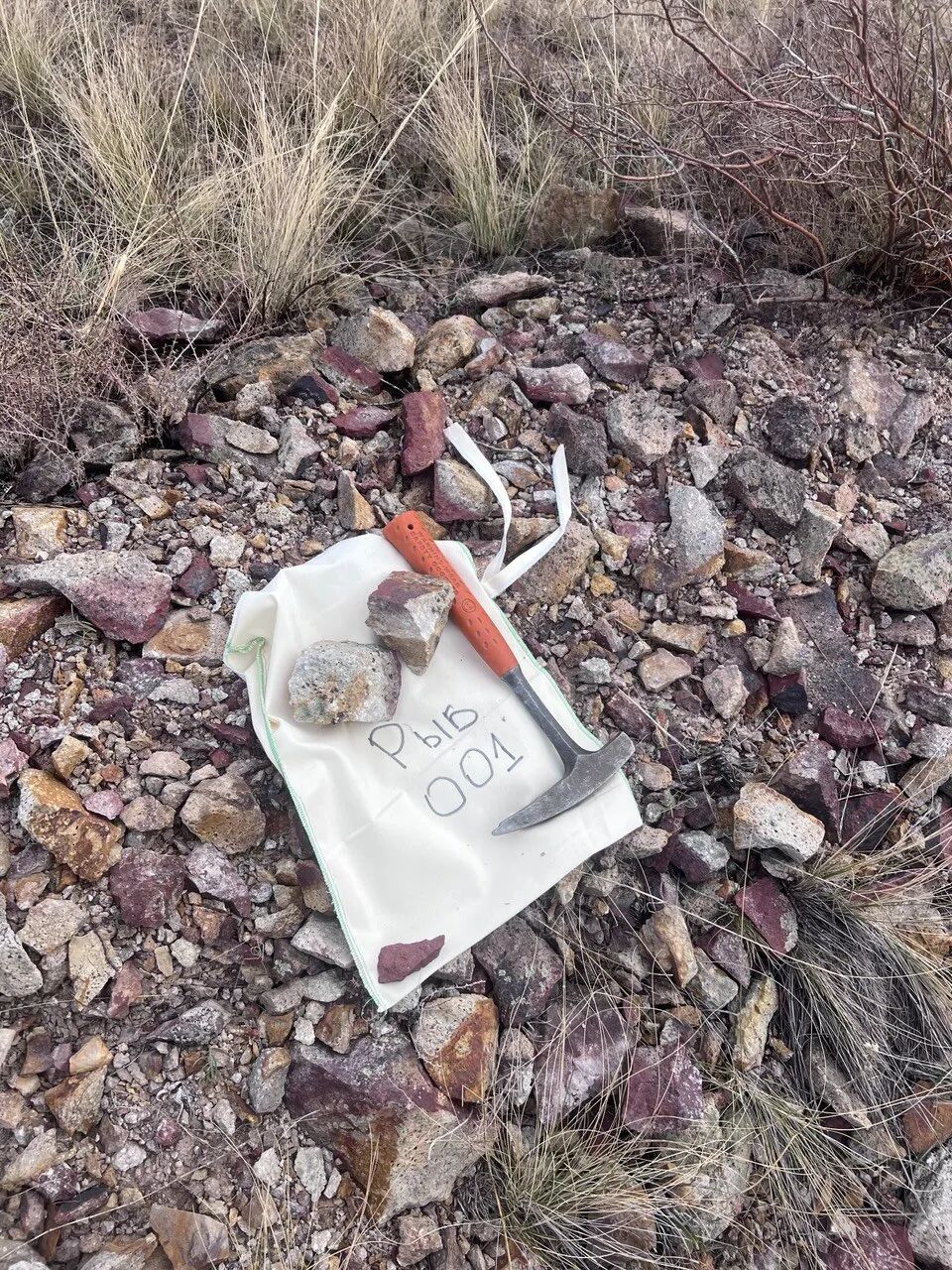
As AI begins reading geological reports, processing exploration data and helping compare targets, the question “Will geologists be replaced?” becomes unavoidable. Answering it first requires a clear view of what actually moves mineral exploration forward.
The subsurface cannot be observed directly and completely. Exploration judgments usually come from the combined analysis of regional geology, deposit models, geochemical and geophysical surveys, remote sensing, drilling information, historical reports and field experience. Every new survey and every new drill hole can add evidence—or force the team to reconsider an earlier interpretation.
AI can expand the amount of material that can be processed and analysed, but it is also constrained by data quality, model boundaries, task definition and feedback from reality. A fluent answer does not mean that the “truth underground” has been mastered.
The effect of AI on geology therefore has to be discussed through specific work: which tasks can it support? Which judgments must geologists retain? When these capabilities are combined, can a team formulate, test and revise geological hypotheses more effectively?
01From Models to Tasks
AI in mineral exploration is expanding from data analysis into information organization and task execution. These capabilities can coexist and need to be combined according to project conditions.
Machine learning and deep learning can support target prediction, remote-sensing interpretation, geochemical-anomaly recognition and geophysical-data processing, helping teams find patterns in multisource data that are difficult to identify directly. As the scope grows, historical reports, drilling records, maps, GIS data and unstructured text are also entering AI-assisted processing.
For a geological team, the value of organizing information lies in placing scattered material under specific questions: which facts can be traced to original records, why did different studies reach different interpretations, and which critical constraints are still missing? The answers create a foundation for later analysis.
When large language models, specialist models and agents are connected to project materials and computational tools, AI can further assist in understanding tasks, selecting methods, calling tools and organizing outputs. Its role extends beyond a single question and answer to a sequence of steps.
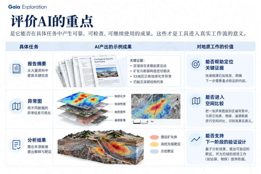
The key criterion for evaluating AI is whether it can produce reliable, inspectable and reusable results in a specific task. Can a report summary locate critical evidence? Can an anomaly map enter a spatial comparison? Can an analysis support the design of the next validation stage? This is what it means for a tool to enter a real workflow.
Turning Data into Understanding
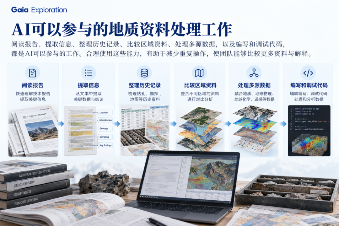
AI can participate in reading reports, extracting information, organizing historical records, comparing regional material, processing multisource data, and writing and debugging code. Used appropriately, these capabilities reduce repetitive operations and allow teams to compare more information and more interpretations.
More information, however, does not automatically produce a more accurate judgment. Whether an anomaly matters for exploration still has to be interpreted in relation to local structure, stratigraphy, magmatic activity, fluid processes and existing engineering information.
Geologists need to keep asking: does this pattern fit the local mineral system? Does the candidate target have plausible geological controls? Which information is dependable evidence, and which is merely a statistical association? What hypothesis is the next drill hole actually intended to test?
Even when a model produces complete prose and clear maps, the team still needs to inspect data quality, spatial correspondence, analytical scale and conditions of applicability. Performance in one area cannot substitute directly for validation in another.
For example, if an anomaly is thought to be fault-controlled, the analysis should explain the spatial relationship between the anomaly and the structure, identify the observations supporting that interpretation, and state which field investigations or engineering constraints are still needed. Useful AI output should help geologists formulate, test and revise hypotheses, while making clear what evidence the next step requires.
03Letting Evidence Constrain Conclusions
Geologists may overlook information, rely too heavily on experience, or reach conclusions too early under time and budget pressure. AI can likewise inherit biases from training data, mistake correlation for causation and provide answers that are too certain when critical information is missing.
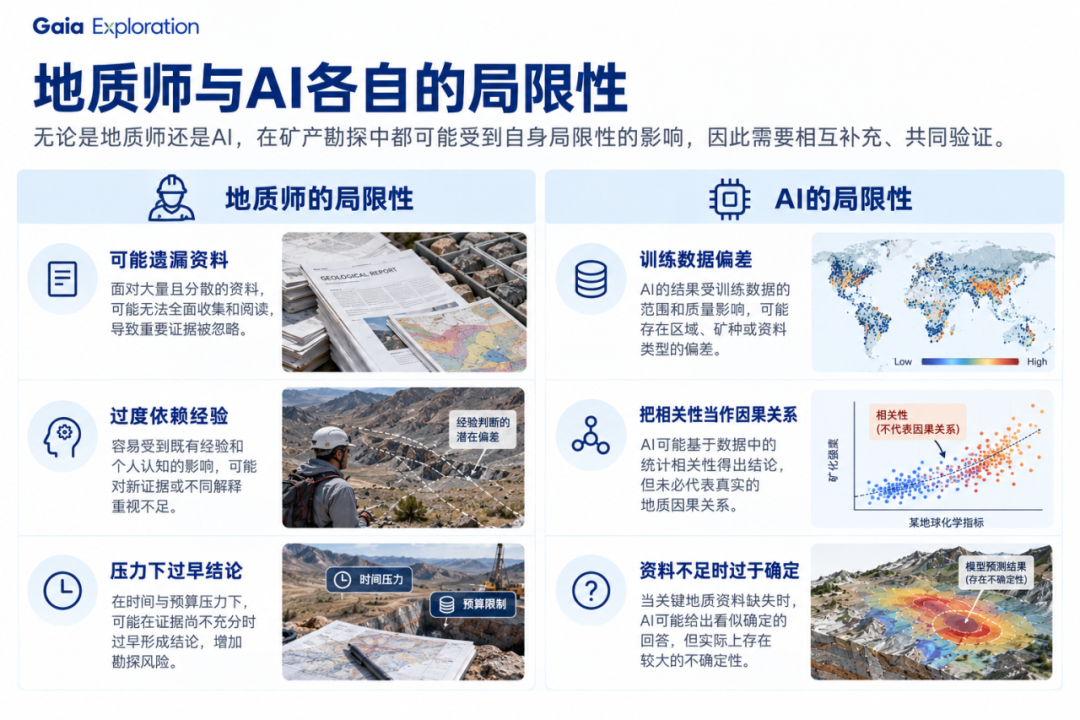
Subsurface data are sparse and incomplete, while mineral deposits show substantial heterogeneity and regional variation. A model that works in one metallogenic belt may not remain valid in another region or deposit type. Complete prose and polished graphics cannot replace evidence.
Reliable analysis needs an inspectable evidence chain: where did the conclusion come from, which assumptions does it depend on, is there contrary information, and how could missing data affect the judgment? These questions should run through the analysis, not appear only as a final check when the deliverable is submitted.
“Human in the loop” also needs to become a clear division of responsibility. AI expands the scope of information retrieval and analysis, compares interpretations and executes tasks; geologists review evidence, correct hypotheses, design validation and decide what happens next.
When new reconnaissance, sampling, geophysics, drilling or underground data enter a project, existing interpretations must continue to be tested. Formulating hypotheses, finding evidence, validating and revising understanding is the geological cycle into which AI should be integrated.
04Connecting the Complete Workflow
A real exploration task often involves reports, specialist data, maps, spatial relationships and engineering constraints at the same time. Different stages use different data structures, analytical methods and validation standards, so the right capabilities need to be connected.
Report agents help understand and analyse historical material. Geochemistry and geophysics agents handle their respective specialist problems. Remote-sensing and spatial-analysis agents extract and compare regional information. GIS-related agents organize maps and spatial data. Agents focused on exploration design assist with work programmes, drilling plans and the next validation tasks.
Specialist agents organize steps around a task, call tools and form outputs, while specialist models provide analytical capability for more specific prediction, optimization or inversion problems. Behind them, project data, professional knowledge, computational tools and real exploration feedback must be connected if they are to support project judgment together.
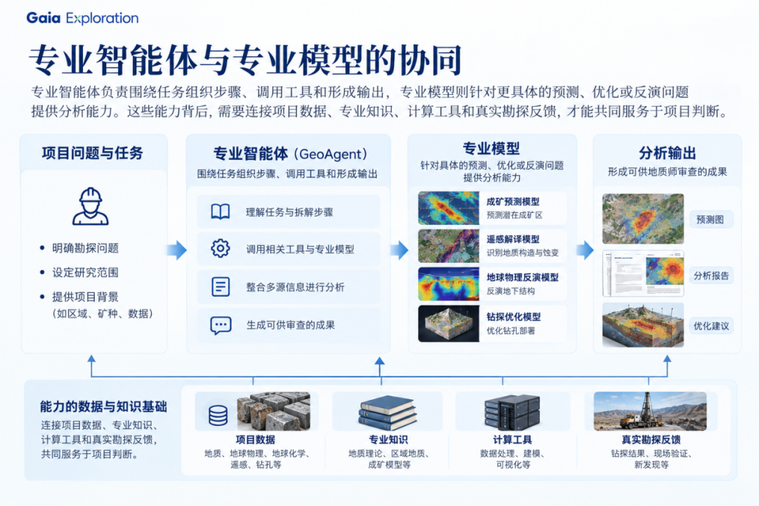
The key to collaboration is allowing the result of one stage to enter the next. Interpretations in historical reports need to be compared with new geochemical, geophysical or remote-sensing information. Spatial analysis needs to constrain target discussions. Target discussions then need to become questions that can be tested through fieldwork.
For example, after report research suggests a particular type of mineral system, the team can check whether the relevant strata, structures and anomalies correspond spatially, then plan investigation around the evidence gaps. If new drilling or underground data conflict with the original hypothesis, the interpretation, model applicability and next deployment should be reassessed.
This requires tasks to share the necessary project context and conclusions to retain their sources, conditions of applicability and uncertainty. When new evidence arrives, the team can then determine which understanding needs revision instead of reorganizing material and restating the background every time a tool changes.
The value of a complete workflow is continuity among information, analysis, hypotheses, validation and feedback. AI’s contribution to exploration should also be evaluated within this continuing process of understanding the subsurface.
05What GAIA’s Agents Can Do
The Gaia Geoscience Agent Platform launched by GAIA Exploration is a work environment for real geoscience tasks that progressively connects specialist agents, project data, models and tools.
Its working model is straightforward: geologists define the question and professional boundaries; agents use project context to help understand data, select methods, call tools and form outputs; geologists then conduct the professional review.
Users can begin with tasks such as “organize historical reports,” “analyse a geochemical dataset,” “compare candidate targets” or “inspect drilling information.” Agents assist in advancing analysis, maps and report preparation, and form next-step recommendations for professional review. Some file organization, format conversion and repetitive operations can be supported, allowing geologists to focus more closely on mineralization interpretation, evidence judgment and engineering decisions.
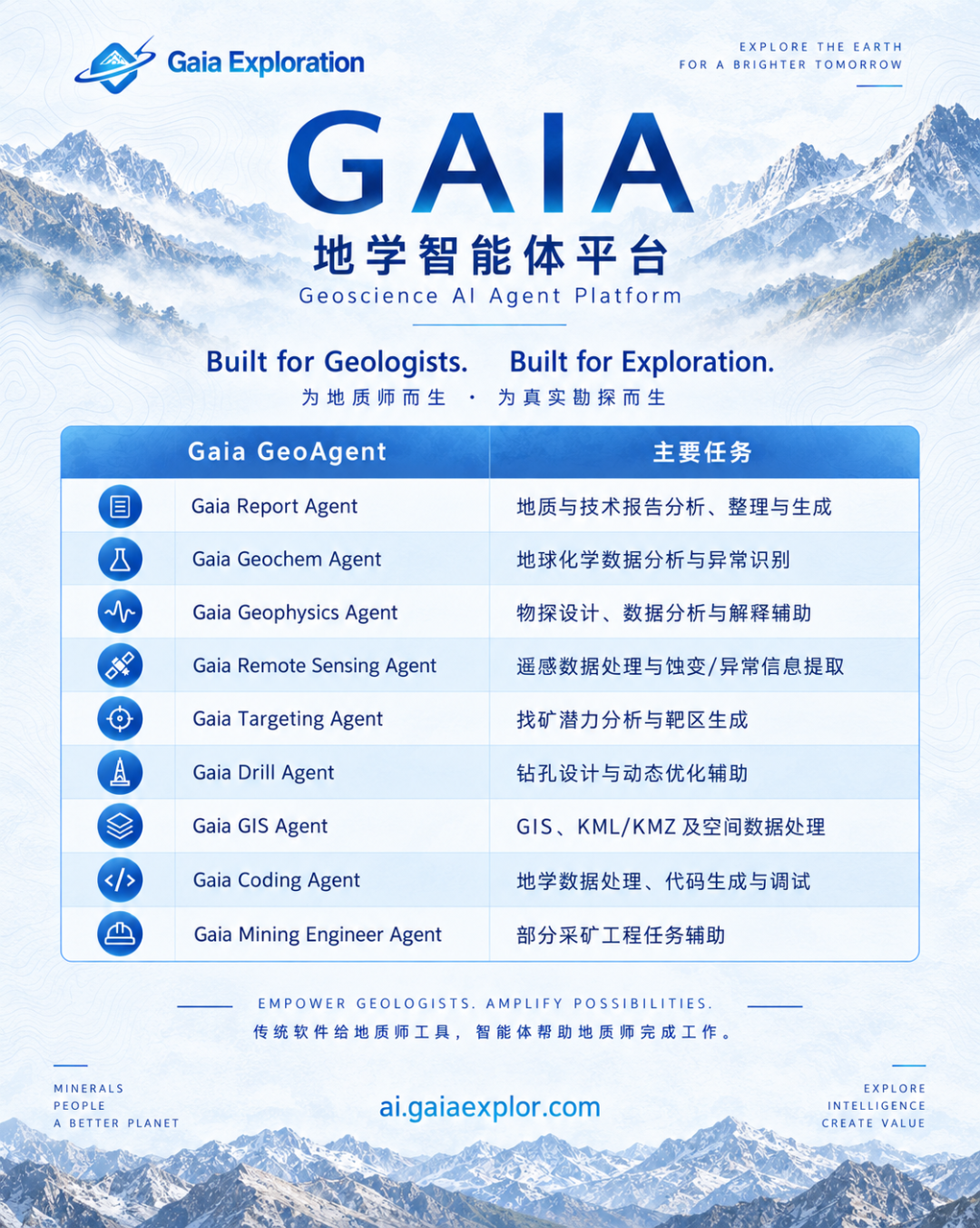
According to the platform release, GAIA’s specialist-agent system covers nine types of task corresponding to different parts of a geological team’s daily work.
Information research: Gaia Report Agent supports technical-report analysis, organization and generation, helping clarify project background, historical interpretations and information that still needs checking.
Specialist data analysis: Gaia Geochem Agent, Gaia Geophysics Agent and Gaia Remote Sensing Agent address geochemistry, geophysics and remote-sensing tasks respectively, assisting with data processing, anomaly recognition and the organization of interpretations.
Targets and drilling: Gaia Targeting Agent focuses on mineral prospectivity and target-related work; Gaia Drill Agent supports drilling design and dynamic optimization, providing analytical support for professional discussion and validation deployment.
Spatial and engineering support: Gaia GIS Agent supports GIS, KML/KMZ and spatial-data processing; Gaia Coding Agent assists with geoscience data processing, code generation and debugging; Gaia Mining Engineer Agent supports selected mining-engineering tasks.
Within one project, report research can clarify the background first, specialist data analysis can add constraints, and spatial processing and target comparison can organize the information for later work. By continually deepening this collaboration, GAIA aims to reduce the burden of repeatedly importing material, explaining context and reorganizing results while moving between tools.
For geologists, researchers and exploration managers, the platform supports document reading, data analysis, spatial processing, code and map preparation. It expands the scope of research and leaves more attention for interpretation, review and programme design.
For mining companies, mineral-rights holders and small exploration teams, the platform can help organize project materials, connect multidisciplinary tasks and prepare stage results. A team can begin with its most urgent task, test how agents complement current capabilities and support continued project progress.
For resource investors and project decision-makers, agents can help explain technical information, identify evidence gaps and questions that still require verification, and provide a basis for communication with professional teams. Technical conclusions and their conditions of applicability still require professional review.
GAIA currently focuses on geoscience and mineral-exploration tasks, continually deepening collaboration among specialist agents, the project environment, data and tools. More complete geoscience-intelligence infrastructure remains a long-term direction.
GAIA adheres to “AI + HI”: AI assists pattern recognition and probabilistic inference, while human experts remain responsible for geological judgment and field verification. We aim to help teams build testable subsurface hypotheses, make judgments earlier, reduce exploration risk and turn agents into professional assistants for real geological work.

Learn about GAIA Exploration: gaiaexplor.com
Gaia AI Platform: ai.gaiaexplor.com
Better decisions. Earlier stages. Lower risk.
06Expanding Capability and Clarifying Responsibility
In the past, how much information a geologist could process and how deeply they could investigate projects depended heavily on experience, team size, access to material and available time. These conditions remain important with AI, but new support is available for some information organization, preliminary analysis and tool operation.
Experienced geologists therefore have an opportunity to review more regional and historical material, compare more candidate targets and mineralization interpretations, and identify worthwhile research questions earlier. Efficiency should be measured by whether the work produces clearer research directions, fuller evidence comparisons and more focused validation programmes.
Small exploration companies often lack the resources to maintain simultaneous teams for data analysis, GIS, remote sensing, geochemistry, geophysics and technical reporting. Agents can supplement capabilities for selected tasks and support more systematic early research; their actual effect needs to be evaluated against output quality, review cost, working time and field feedback.
As accessing information and carrying out preliminary analysis become easier, professional experience will concentrate on a few critical questions: which results deserve trust, which contradictions must be investigated, which hypotheses justify fieldwork, and where should resources go in the next stage?
Understanding mineral systems, judging data quality and selecting validation paths under uncertainty all need to operate within a richer body of information. AI can expand the scope of geologists’ analysis; geologists need to decide what that information means for the project and choose the next action accordingly.
To turn expanded capability into actual results, a team must also make clear which tasks can rely more heavily on AI assistance, which need to proceed collaboratively, and which decisions must remain with people who have the relevant competence and responsibility.
Information organization, extraction, coding and preliminary processing can use AI support when inputs, methods and checking requirements are explicit, reducing repetitive labour. Complex pattern recognition and multisource data fusion can draw on specialist models to broaden analysis, with geologists reviewing data quality, spatial consistency and geological plausibility.
Mineralization interpretations, geological hypotheses and validation programmes require repeated human–AI collaboration. AI helps compare material and organize supporting and conflicting evidence; geologists judge it against regional context and field experience so that statistical association is not treated directly as a geological conclusion.
Field understanding, engineering deployment, risk acceptance, capital allocation and final exploration decisions still require judgment and responsibility from appropriately qualified people. Using AI does not remove those responsibilities or permit necessary professional review and field verification to be skipped.
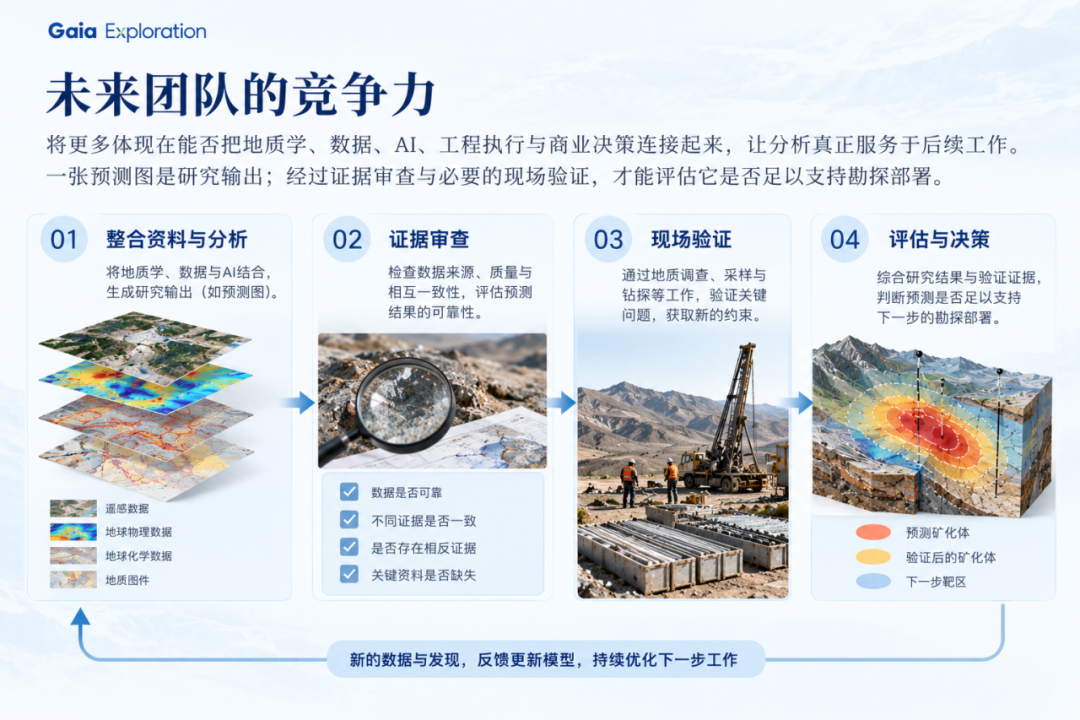
A team’s future competitiveness will depend increasingly on whether it can connect geology, data, AI, engineering execution and commercial decisions so that analysis genuinely serves later work. A prediction map is a research output; only after evidence review and necessary field validation can the team assess whether it supports exploration deployment.
Bring AI into Real Geological Workflows
Progress in mineral exploration is reflected in formulating geological hypotheses worth testing, obtaining effective evidence, continually revising understanding and gradually reducing uncertainty that affects investment, drilling and development decisions.
AI is changing which information geologists can process, which interpretations they can compare and how many tasks a team can advance. Whether those changes become real value depends on tool capability and professional judgment working effectively together in real projects.
Bring AI into real geological workflows and concentrate professional judgment on critical questions. This is also the direction GAIA hopes to advance together with geological teams.