Drilling, geophysics, geochemistry, remote sensing and the results of years of exploration are data assets accumulated over long periods by geological exploration organizations and mining companies. They provide evidence for exploration judgments and often involve sensitive information. Before artificial intelligence can improve how efficiently those materials are used, one question must be made clear: who controls the data, and in what form does intelligent capability enter the existing workflow?
This need not be a binary choice between “protecting data” and “using artificial intelligence.” Different access methods do, however, create different data flows and require different management arrangements.
The use of drilling, geophysical, geochemical and related materials should rest on clearly defined data boundaries and professional review.
01Choose an Access Method According to the Data Boundary
GAIA’s Geoscience Agent Platform is now online and can be tried by scanning the code.
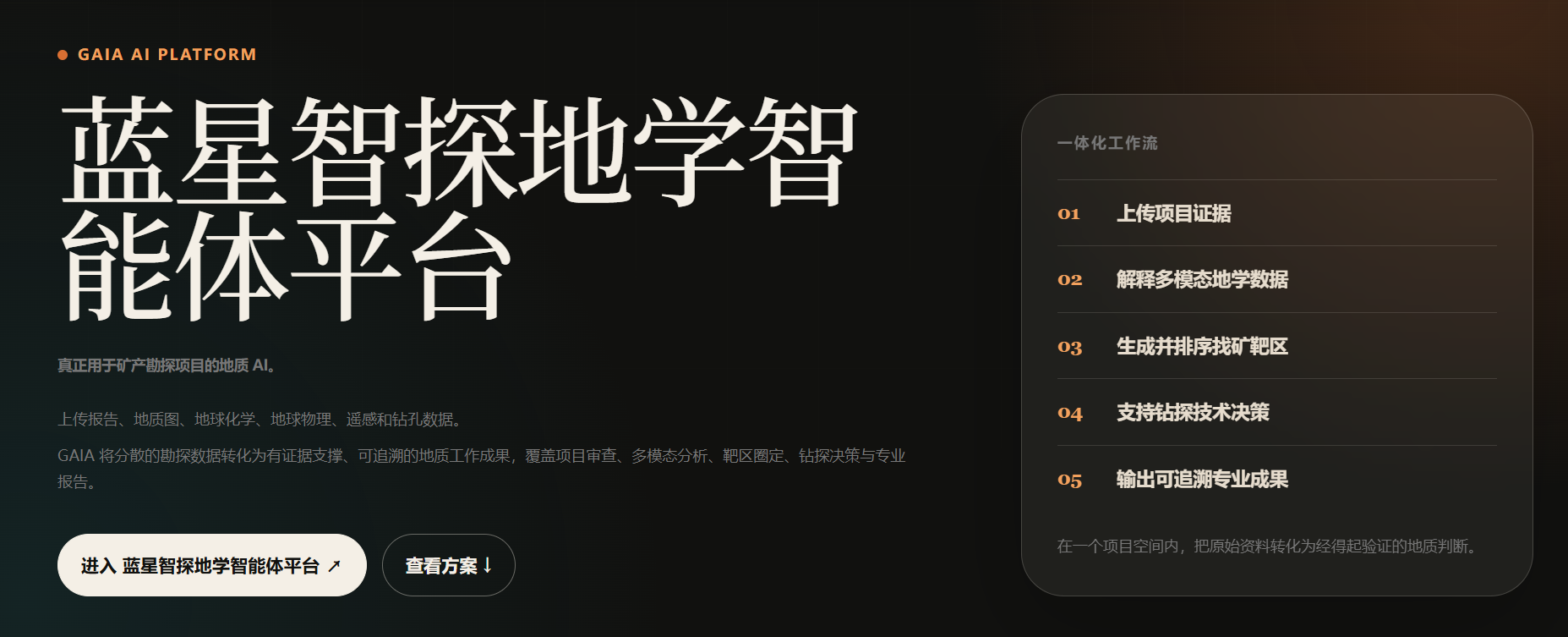

In addition to using the platform directly, geological exploration organizations and mining companies can discuss two other approaches according to their own conditions: API integration or local deployment.
API integration: call geoscience-intelligence capabilities from an existing business system and data environment, preserving the original data-management approach and reducing system modification. But API integration does not automatically mean that “data never leave the domain.” The specific plan must confirm which content enters a request and how it is transmitted and recorded.
Local deployment: assist the organization in deploying platform and model capabilities within its own environment, providing a path for geological data to remain local and under the organization’s control. After the model is deployed locally, access permissions, network connections and operating and maintenance rules still need to be designed together.
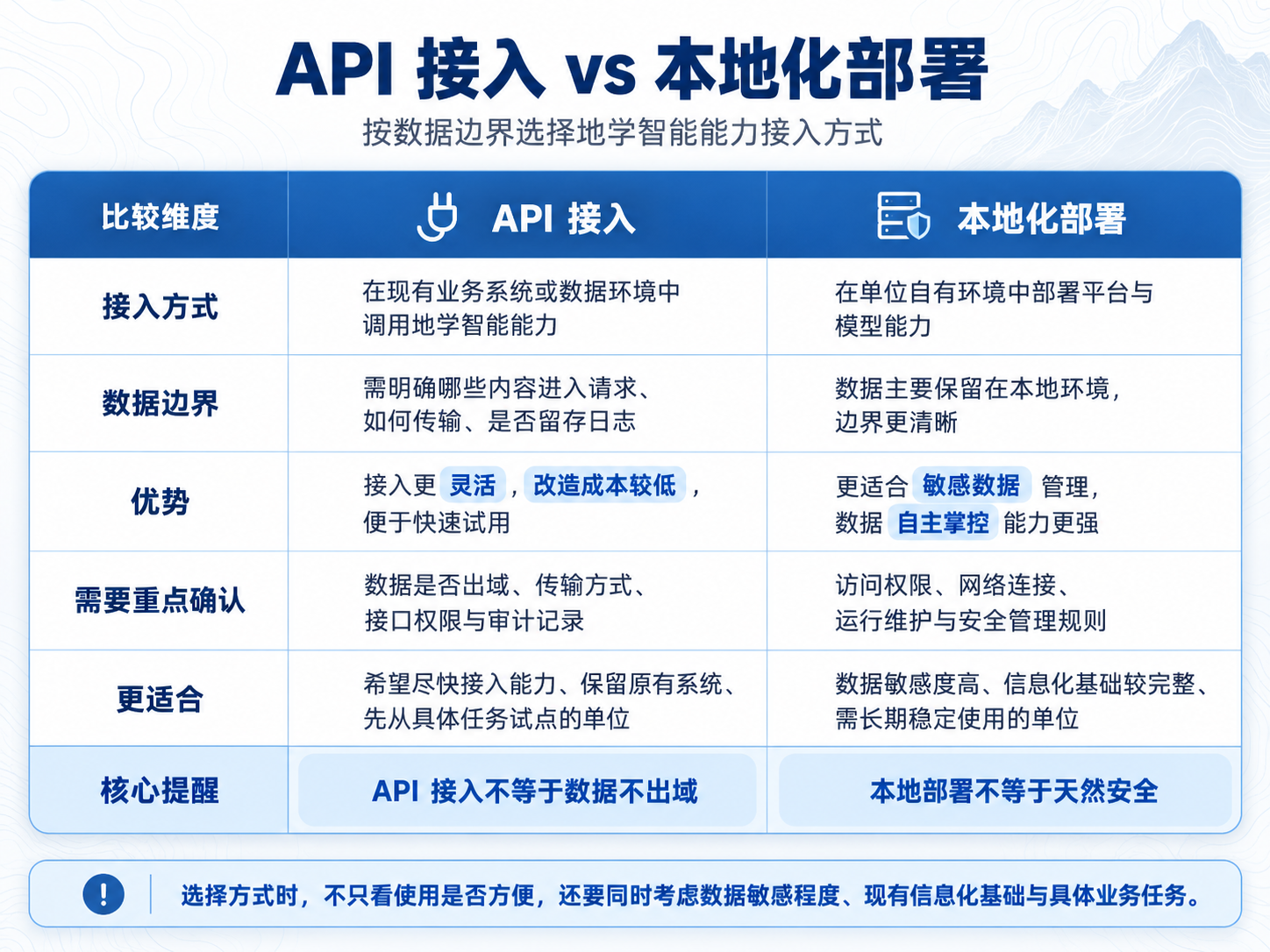
The choice should not depend only on convenience. Data sensitivity, existing digital infrastructure and the business task need to be considered together.
API integration and local deployment have different data boundaries; the actual transmission, storage and processing methods still need to be verified against the proposed solution.
02Information Can Be Called, but Judgment Needs Evidence
Geoscience large models can assist with information organization, knowledge retrieval, geological analysis and report preparation, making information scattered across files and systems easier to find and use. Finding information, however, is not the same as reaching a reliable geological conclusion.
For example, deciding whether a geophysical anomaly deserves priority validation first requires checking its location, extent and data quality, then comparing it with regional geology, geochemical information and existing drilling records. Do these lines of evidence support the same geological interpretation? Are there other reasonable explanations? Materials with inconsistent coordinates, scales or acquisition times cannot be assembled directly into a conclusion.
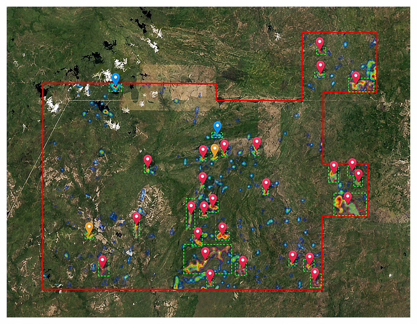
GAIA supports mineral-prospectivity judgment by fusing multisource geoscience data. It can prioritize candidate targets and provide confidence, an evidence chain and a suggested validation path. Professionals must still review the data and interpretations and decide whether to conduct additional investigation, revisit existing results or proceed with further exploration. An anomaly is a clue; a target is a judgment awaiting validation. Neither is equivalent to a discovered orebody.
Geophysical anomalies need to be reviewed against geology, geochemistry, drilling and other materials; candidate targets still require validation.
Start with a Specific Task
An organization seeking to introduce geoscience-intelligence capability can start with one clearly defined task: for example, searching across reports for drilling information and successive geological interpretations in a particular area, then determining whether the required materials can be called under existing permissions. Once the task is explicit, it becomes easier to compare the suitability of platform use, API integration and local deployment.
GAIA can discuss integration or deployment with geological exploration organizations, mining companies and research institutions that have relevant use cases, taking account of data sensitivity, existing systems and specific needs. More importantly, the solution should state clearly which materials can be used, how outputs can be traced to supporting evidence, and which judgments require review and validation by geological professionals.
Conclusion
The environment in which geological data remain determines how intelligent capability can be integrated; information quality and the validation process determine whether intelligent outputs can support the next task. Geoscience large models can serve exploration judgment more safely only when both data boundaries and evidence boundaries are clear.
Who controls the data, and what evidence supports the judgment, must both be explainable.
Whether you are a geological exploration organization, mining group, mine operator or research institute with specialist geological data and application scenarios, you are welcome to discuss cooperation with GAIA Exploration.
We can jointly design API integration, local deployment or platform-use solutions according to your data sensitivity, existing digital infrastructure and specific business needs.
Keep the data local and let intelligence serve the business.
Bring artificial intelligence into the front line of geological exploration and mining production.
Contact GAIA Exploration to arrange a demonstration of the Gaia Geoscience Agent Platform and discuss cooperation.