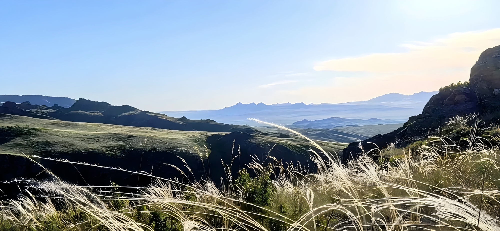
How large is a mining concession of nearly 200 km²? It is about 19,900 hectares. If the whole area were covered with a basic 200 m × 200 m grid, the exercise would involve nearly 5,000 theoretical grid cells.
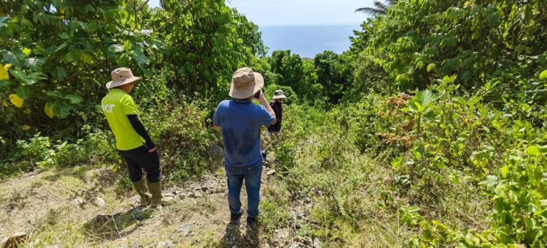
In mountainous terrain with dense vegetation, geologists must also complete route reconnaissance, sampling, transport, laboratory testing, data processing and anomaly mapping. By the time the full program is finished, substantial time and cost may already have been committed.
Yet early-stage budgets are usually limited. Where should the first field team go? Where should the first samples be collected? Which areas deserve priority investment?
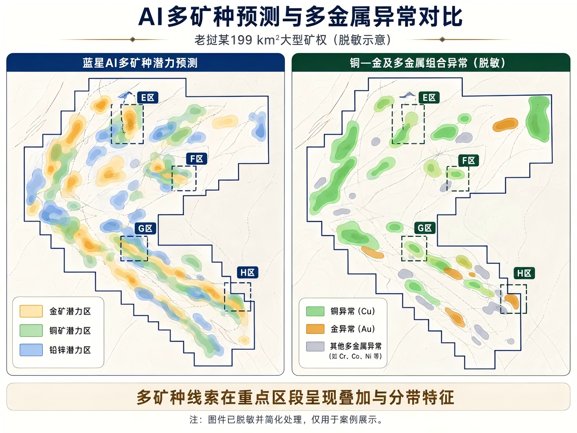
In this case, Gaia Exploration was working on a large concession of about 199 km² in Laos. With only the project coordinates and concession boundary available at the outset, Gaia AI assessed prospectivity across the entire concession for gold, copper, lead-zinc and other polymetallic directions, and delineated a number of priority areas.
What happened next was more important. After the project owner completed geochemical exploration, the measured anomaly zones were compared with the prospectivity targets that Gaia AI had delineated earlier. Multiple priority areas showed a high degree of agreement in both location and overall trend.
This comparison across a 199 km² concession raises a practical question: before large-scale field programs are fully deployed, can AI help a geological team identify the directions that deserve investment first?
PART 01
At 199 km², the hard part is not finding anomalies—it is setting priorities
On a large concession, finding anomalies is often not the hardest task. The real challenge is deciding which anomalies have clear metallogenic significance when faults, intrusions, alteration, geochemistry and remote-sensing information all need to be considered together.
The project was not focused on a single commodity. It involved potential gold, copper, lead-zinc and other polymetallic mineralization. Each commodity has different metallogenic conditions, ore-controlling structures, hydrothermal processes, alteration styles and indicator-element associations.
A remote-sensing anomaly, for example, may result from ordinary weathering or from hydrothermal alteration. A fault may be an ordinary structure or a major pathway for ore fluids. Relying on a single data layer can therefore turn “anomalous” into a false assumption of “prospective.”
Early-stage analysis of a large concession must go beyond asking where the geology looks different. It must ask whether anomalies are spatially related, whether they overlap favourable strata, intrusions and structures, and whether they form a coherent metallogenic evidence chain. This was the first problem Gaia AI set out to solve in this case.
PART 02
Before full field deployment, Gaia AI ran the first screening pass
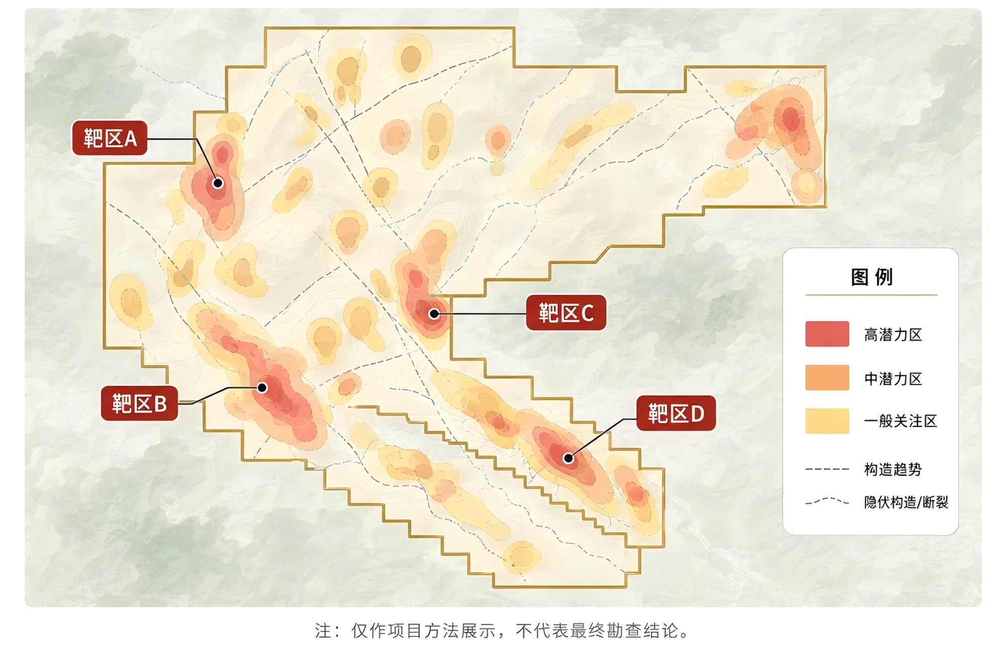
The analysis was not simply a matter of placing a few “possible ore” points on a map. Starting with the concession coordinates and boundary, Gaia AI first built regional understanding at the scale of the whole concession and then progressively narrowed the focus to specific prospective areas.
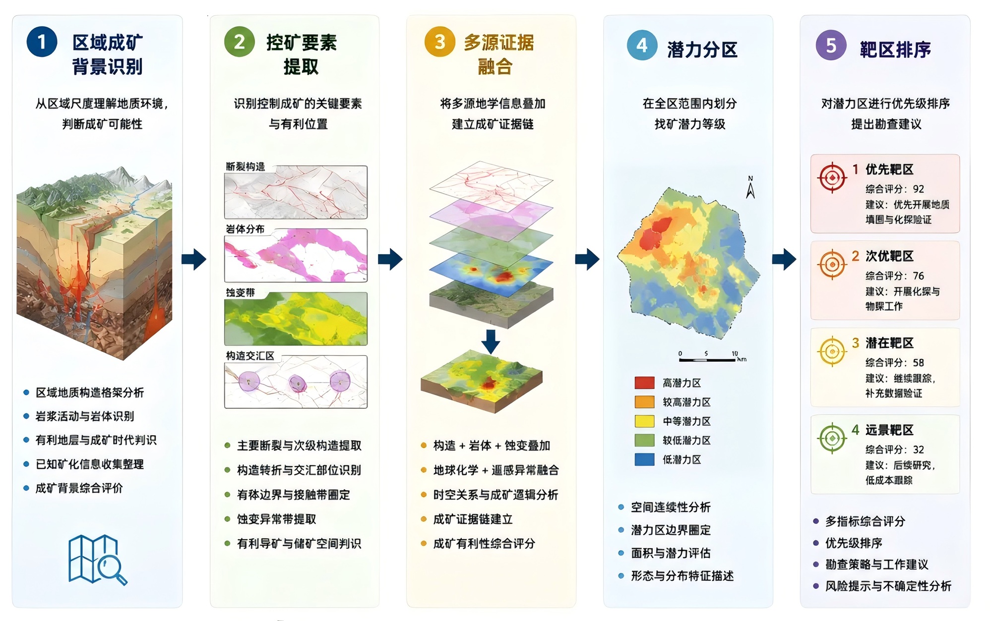
First, understand why the region could be mineralized. AI reviewed the geological setting, major structural framework, magmatic activity, favourable stratigraphy and known mineralization. The question was not whether one point was anomalous, but whether the concession lay in a favourable metallogenic environment and what mineral systems could plausibly occur there.
Gold, copper and lead-zinc were treated separately so that anomalies for different commodities were not forced into one interpretive model.
Next, identify possible pathways for ore fluids. Ore bodies do not form randomly. In many hydrothermal deposits, faults, fractures, intrusive contacts and structural intersections control the movement and precipitation of mineralizing fluids. Gaia AI therefore identified major and secondary faults, bends, intersections and intrusive boundaries to assess which areas offered more favourable pathways and depositional space.
Then connect scattered anomalies into an evidence chain. A structural anomaly alone does not prove mineralization, and a single alteration feature is not enough to define a reliable target. Gaia AI compares the evidence in one spatial framework: Is the structure favourable? Could magmatism provide heat? Does alteration follow faults or intrusive contacts? Do different anomalies overlap?
Priority rises only when multiple types of evidence recur in the same area. Project materials show that Gaia AI ultimately produced prospectivity results for gold and other polymetallic directions and delivered the priority areas as target maps and overlay imagery.
PART 03
The areas highlighted by AI were later “caught” by geochemical anomalies
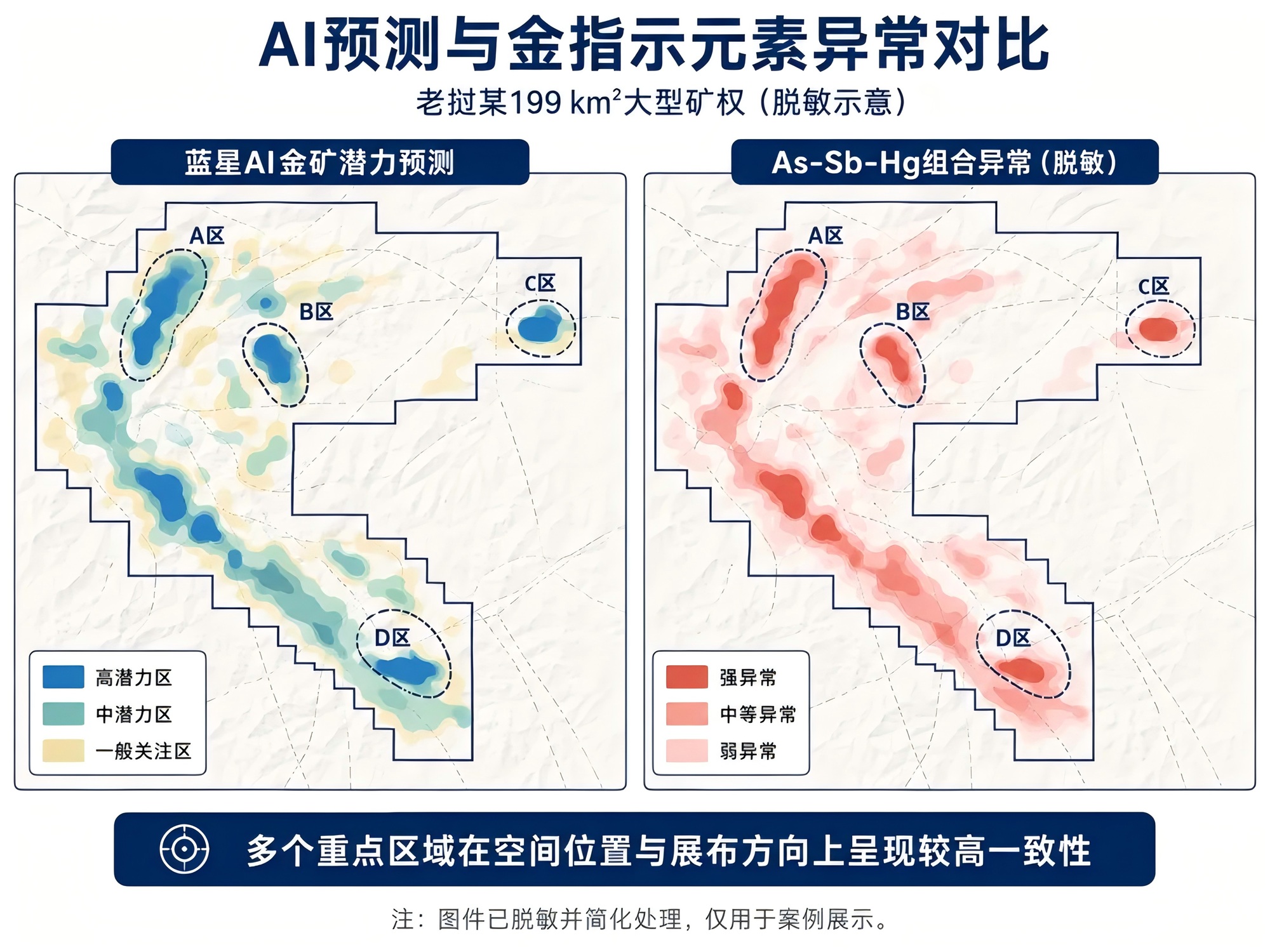
After the AI prediction was completed, field geochemical exploration produced several multi-element anomaly maps. One important result was an As-Sb-Hg association—arsenic, antimony and mercury.
Why does this association matter? In some hydrothermal gold systems, gold itself may occur at low concentrations and be difficult to detect as a strong regional anomaly. Arsenic, antimony and mercury can migrate farther and may form more visible halos above or around an ore body or near hydrothermal pathways. They are therefore commonly used as indicators of gold mineralization.
The project results showed multiple As-Sb-Hg anomaly zones. Several gold-prospectivity areas delineated earlier by Gaia AI corresponded well with these anomalies in both spatial position and overall trend.
In other words, before directly using those geochemical results, AI had already identified several areas that later proved worthy of closer attention.
PART 04
Not just gold: a large concession may record multiple mineralizing events and commodities
This project is not a simple single-commodity system. In addition to gold-related anomalies, the project materials show combined anomalies related to copper, gold and other metals.
When multiple metal anomalies occur together, several geological scenarios are possible: different metals may be associated within one mineral system; the area may have experienced multiple hydrothermal events; different styles of mineralization may overlap spatially; or shallow anomalies may be offset from a deeper mineralization centre.
That is why Gaia AI did not label the whole concession simply as a “gold project” or a “copper project.” Prospectivity was analysed separately for gold, copper, lead-zinc and other directions. Modelling each commodity independently, delineating separate areas and then ranking them against commodity-specific geological conditions and indicators better reflects real metallogenic processes than using one composite heat map for everything.
Where gold indicator anomalies overlap or show systematic zoning with copper and polymetallic anomalies, the geological team still needs to determine whether the area may contain a larger and more complex multi-stage hydrothermal system.
PART 05
“High agreement” does not mean an ore body has already been discovered
A critical distinction is required: strong agreement between AI targets and geochemical anomalies does not mean a mineable ore body has been found, and it certainly does not amount to a resource estimate.
Geochemical anomalies describe enrichment of elements at or near the surface. AI prospectivity zones represent the possibility of mineralization supported by regional geology, structures, alteration and other multi-source evidence.
The two approaches use different evidence but produced similar results in several priority areas. That is valuable because it identifies places where further geological work is justified. The comparison in the project materials also shows clear correspondence between AI-delineated areas and measured geochemical anomalies at multiple locations.
The real conclusion is not that “AI has found the ore,” but that Gaia AI can help geological teams identify areas worth validating first during the early stage of a large concession.
Delineating prospective areas within 199 km² is only the first step. The project team still needs geological mapping, route reconnaissance, infill sampling, geophysics, trenching and drilling to progressively test the source of anomalies, the scale of mineralization and its depth continuity.
PART 06
AI changes the order of work, not the rules of exploration
Traditional early-stage exploration on a large concession often starts with broad coverage and then narrows the target area as survey results accumulate. The approach is reliable, but it can spread time and budget too thinly across a large area and allocate similar effort to zones with very different exploration value.
Gaia AI offers a different sequence: first screen the entire concession rapidly to identify favourable metallogenic conditions and key anomaly combinations; then rank prospective areas according to the consistency of multiple evidence types; finally, deploy geological reconnaissance, geochemical sampling, geophysics and engineering validation preferentially where the evidence is concentrated.
The workflow changes from “cover broadly, then eliminate” to “AI screens first, geology validates next, and engineering escalates in stages.” This does not reduce the professional demands of geology; it makes fieldwork more targeted.
Across 199 km², even a basic 200 m × 200 m grid would involve nearly 5,000 theoretical cells. Gaia AI is intended to help a project team decide where to focus before committing to large-scale infill work.
PART 07
Gaia AI is not a substitute for geologists
Mineral exploration is a system of multi-stage validation. No matter how mature an algorithm becomes, it cannot directly replace geological mapping, sample analysis, geophysics or drilling.
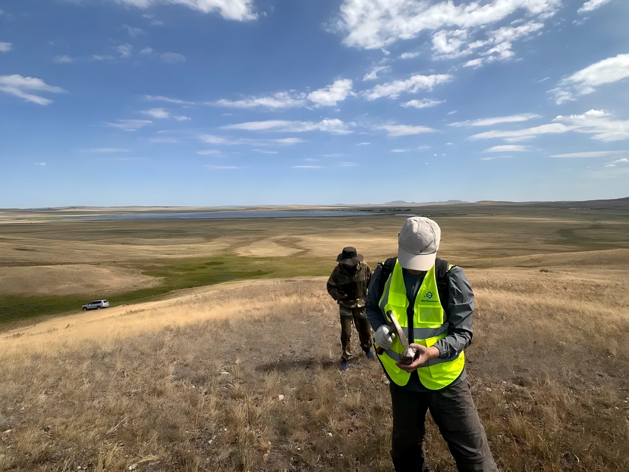
Gaia Exploration’s position on AI-assisted exploration is clear: AI identifies patterns, relationships and priorities across large, multidimensional datasets; geologists make the final judgement using regional experience, field observations and engineering evidence.
In this 199 km² Laos case, Gaia AI first worked from limited project information to identify gold, copper, lead-zinc and other polymetallic prospective areas. The project owner later conducted geochemical exploration that independently tested several priority areas. The two technical paths ultimately showed good spatial correspondence in multiple zones.
For large concessions at an early stage, AI can therefore serve as a front-end tool to help answer three practical questions: Where should the team go first? Which anomalies need priority verification? How should the next exploration budget be allocated?
PART 08
Conclusion: first find what is worth validating, then deepen each step
Exploration has never been about getting an answer from one map. Useful AI does not declare “there is ore here” from an algorithm; it helps a team see direction earlier when information is incomplete, the work area is large and budgets are limited.
From a 199 km² concession to a set of prospective targets that can be verified first, Gaia Exploration connects regional metallogenic rules, multi-source geoscience information and geological expertise. The aim is to prevent equal effort being spread across the entire concession, make sampling, geophysics and drilling more directional, and move each exploration dollar closer to areas that genuinely warrant testing.
AI screens first; geologists validate in the field. This does not replace conventional exploration—it makes conventional exploration more focused and efficient.